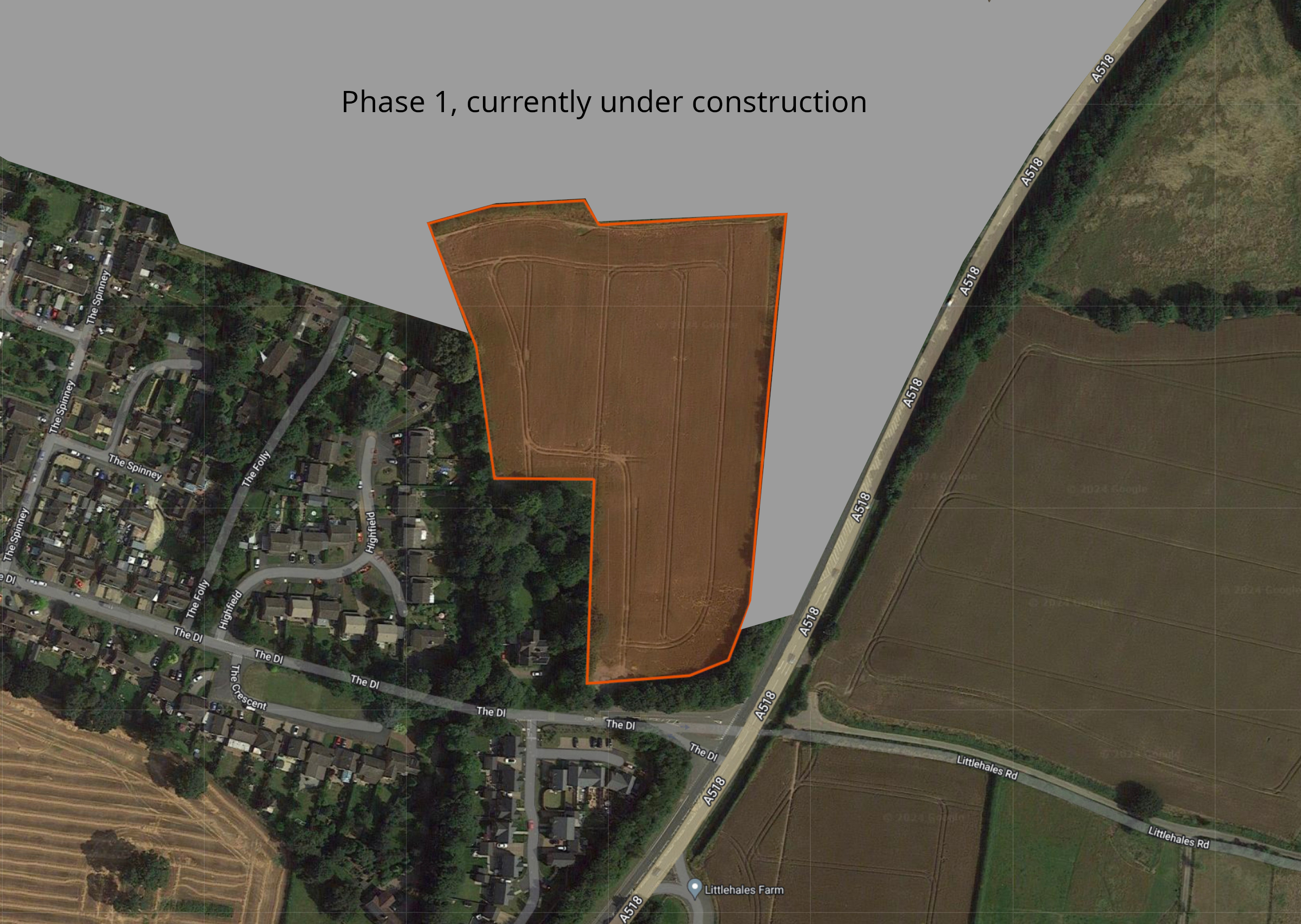
The site for Phase 2 of Hutchison Gate is located within the settlement boundary of Newport. As such, it represents an infill opportunity to deliver much-needed family and affordable homes and is deemed appropriate in terms of local and national planning policy.
Family-owned housebuilder Bloor Homes is preparing a full planning application for Phase 2 of Hutchison Gate. This will deliver:
- 60 high-quality family homes in a range of styles and tenures.
- 39 (65%) market homes in a mix of 2, 3 and 4 bed family homes.
- 21 (35%) affordable homes, in a mix of social rent and First Homes.
- Vehicular access taken via the existing phase of Hutchison Gate, at a point close to its junction with the A518.
- Pedestrian and cycle links from the existing phase.
- Enhancements to the public right of way that links The Dale with The Folly and the existing phase of Hutchison Gate.
- Retention of existing trees and hedgerows, enhanced by additional planting.
- Green public open space and habitat creation, boosting the biodiversity value of the site.
- Sustainability measures including EV charging infrastructure for all homes, PV cells (solar panels) and very high levels of insulation and energy efficiency.
The development will deliver 60 new homes in a range of styles and tenures.
- MARKET HOMES - 39 of the homes (65% of the overall development) will be market homes in a mix of 2, 3 and 4 bed family homes.
- AFFORDABLE HOMES - 15 homes (25%) will be for social rent, including 1, 2 and 3 bed homes. In addition, 6 homes (10%) will be First Homes.
The affordable housing provision will be split between affordable rent (80%) and shared ownership (20%) providing opportunities for those with local connections who are on lower incomes to secure a home of their own in the community.
Yes, 35% of the new homes (21 homes) will be affordable homes. 15 homes (25%) will be for social rent, including 1, 2 and 3 bed homes. In addition, 6 homes (10%) will be First Homes.
First Homes are homes that are sold at a discount of at least 30% against the market value and with a price cap of £250,000 applied. Eligibility criteria apply that ensure they are only available to people on lower incomes, such as key workers. When a First Home is sold to its first owner, a legal restriction is entered onto the Title Register. This restriction is intended to ensure that the title cannot be transferred to another owner unless the relevant local authority certifies to HM Land Registry that the First Homes criteria and eligibility criteria have been met, including the discounted sale price.
All homes will be built in accordance with the latest version of the Building Regulations or the Future Homes Standards in place when construction commences, which both set ambitious construction and energy efficiency standards.
You can find out more about the approach that Bloor takes towards sustainability here: www.bloorhomes.com/buying-guide/sustainability
The vast majority of existing landscape features such as hedgerows and trees will be retained, with hedgerow removal being minimised to a small section in the northeastern corner required to allow for highway access. This, alongside the creation and management of new landscape planting, trees and SUDS features will provide new habitats and enhance the quality of the existing habitats - improving the biodiversity value of the site wherever possible.
Yes, the new homes will be set amongst extensive areas of green space and a network of walking and cycling routes and extensive tree planting across the site.
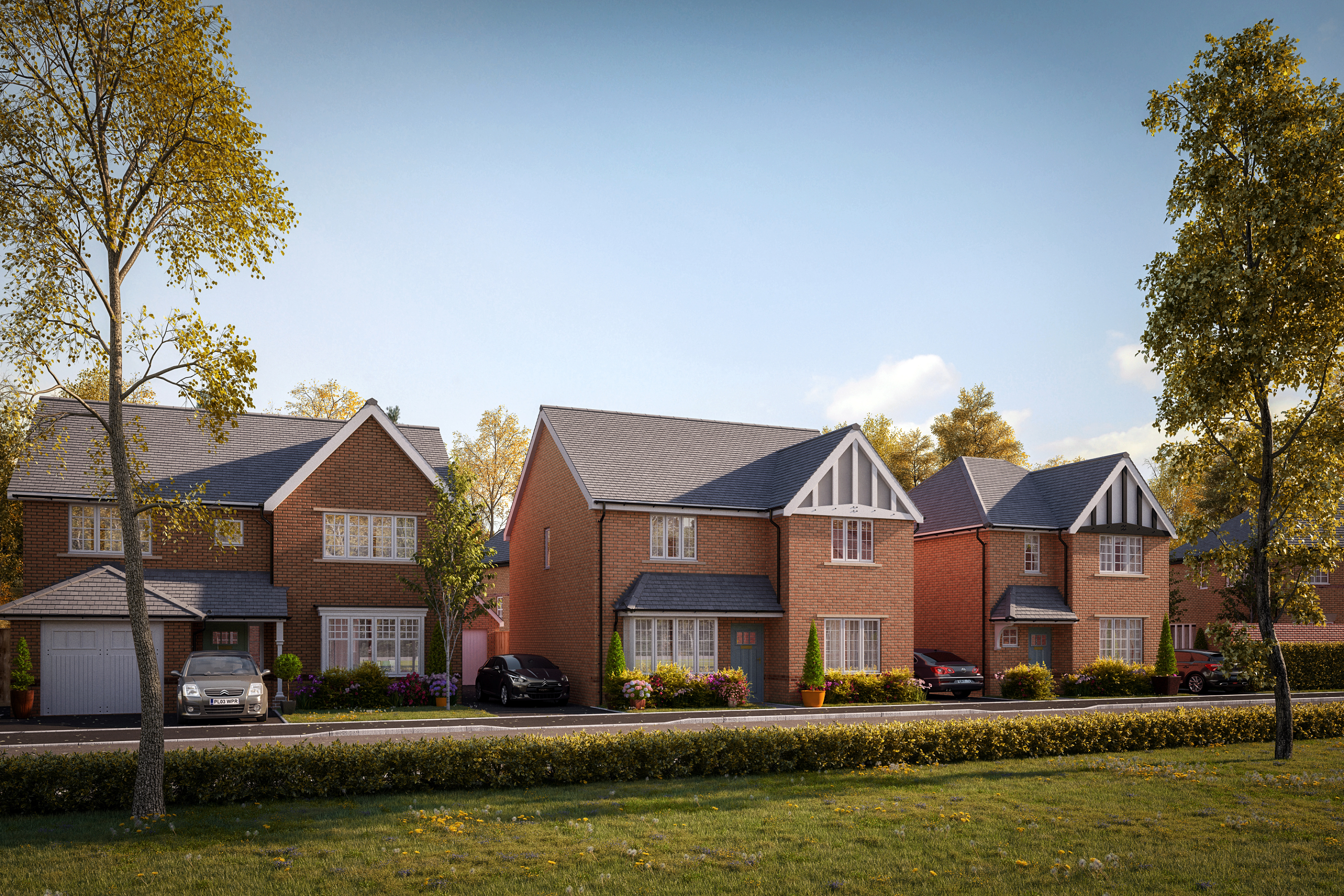
Bloor Homes is currently delivering new homes on the existing phase of Hutchison Gate immediately north of the site. This gives a good indication of some of the types of homes built by Bloor Homes.

Vehicular access to the site will be taken via the existing phase of Hutchison Gate, at a point close to its junction with the A518. There will also be pedestrian and cycle access to the site from the existing phase, as well as enhancements to the new public right of way that passes through the site with the use of Hoggin surfacing to improve accessibility.
The planning application will be informed by extensive technical studies, including a robust Transport Assessment. This report will assess the highway safety and capacity of the surrounding highway network to ensure that the new phase of Hutchison Gate can be safely accommodated.
The site is currently largely comprised of improved agricultural grassland, which is of relatively low value in terms of biodiversity and with no trees within the site itself other than boundary trees and hedgerows. The new neighbourhood will include the retention of the existing perimeter trees and established hedgerows save for a small section of hedgerow which will require removal to create access. Existing landscape buffering on the site’s southern boundary with The Dale and fronting the A518 will also be retained.
Within the site itself, there will be the provision of extensive areas of green public space, including enhancements to the public right of way that links The Dale with The Folly and the existing phase of Hutchison Gate. A green corridor will run along the northern section of the site between the proposed phase and the existing new homes. This will incorporate a SUDs basin, creating new wetland habitat.
There will be significant planting of trees across the site delivering a net gain in the number of trees across the site. Trees at the rear of Highfield and at Chantry will be unaffected by the proposals.
All of these measures will enhance the biodiversity value of the site.
The site is located within Flood Zone 1 of the Environment Agency’s flood map for planning. This means that it has the lowest probability of flooding.
In terms of surface water drainage, the provision of a Sustainable Urban Drainage System (SUDS) as part of the surface water drainage strategy for the development will manage surface water drainage from the development, and has the potential to provide an improvement over the current surface drainage situation for the surrounding area, as well delivering biodiversity enhancements through the creation of wetland habitats.
Any planning consents will include a condition for the agreement of a Construction Management Plan with the Local Authority to ensure that all construction is well managed and minimises its impact on the surrounding area.
Any planning consent for the proposed development will be subject to a S106 agreement which will generate significant financial contributions to be invested into local infrastructure and services such as healthcare, education, public transport etc. This was determined by statutory consultation carried out by the Local Planning Authority with bodies such as the local NHS, the Local Education Authority, Local Highways Authority and others.
We are keen to hear suggestions from local residents and the wider community as we finalise our plans. We have created a consultation website, www.bloorhutchisongatephase2.com, which includes an overview of the plans, as well as an easy-to-use interactive map and online questionnaire. In addition, the local planning authority, Telford and Wrekin Council will carry out further consultation of their own once our planning application is submitted.
